|
Date Filed |
04/07/2016 |
|
|
Castletown Bearhaven, co. |
||
|
Lat/Long |
51° 38’ N |
9° 54’ W |
|
Content complete to – (Date |
Place) |
02/07/2016 |
Knightstown, co. |
Fri 10th June.
A prompt departure from Derrynane - tide higher than when we came in, so
fairly intimidating surf. A grey day,
once out hoisted the main (washing out to dry after last night). Mid morning rounded Bolus Head & could
see, further out, the distinctive cones of rock known as the Skelligs, one home
to a monastry with a climb of 600 steps.
Rain started. Doug saw our first puffin of the trip, not surprising as
we were off
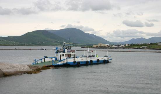
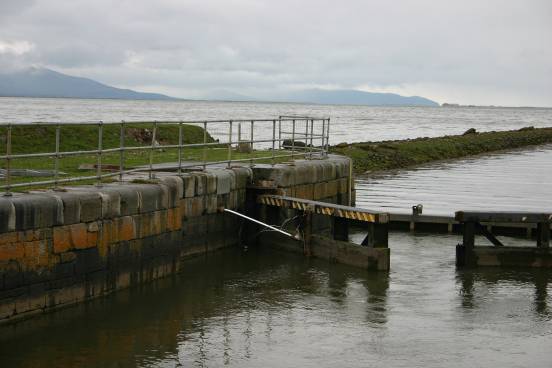
The ferry is double ended, does a non stop service all day, & always seems to have vehicles on board & no queues.
The harbour was a square of pontoons, & not much else – very reminiscent of some projects we had seen in the Med. There was no harbour master or office so no one to pay! The Tourist Office told us this was the case. The island itself is famous as the start point for the first transatlantic telegraph cable, laid in 1857. So next the obligatory stroll round the township & that evening ate at The Royal – the main hotel & very pleasant.
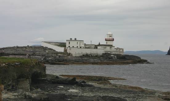
On saturday (11th June) walked, via a lane hedged by freesias & rhododendrons to Glanleam subtropical gardens. Everything was growing rampantly in the gardens, we strolled round their winding up & down paths, then on to the lighthouse we had seen from the boat as we came in.
Sun 12th June. A short trip mid morning to move the boat to Cahersiveen on the mainland, which we hope is more sheltered as the forecast is for more wind. 2.8 nm.
Again the exploratory stroll & supper in a fish restaurant (QC’s) in the town.
On monday (13th June) the forecast wet & very windy weather arrived. We stayed put & in the dryer bits explored more of the town & did some restocking of the larder.
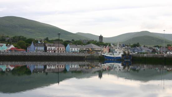
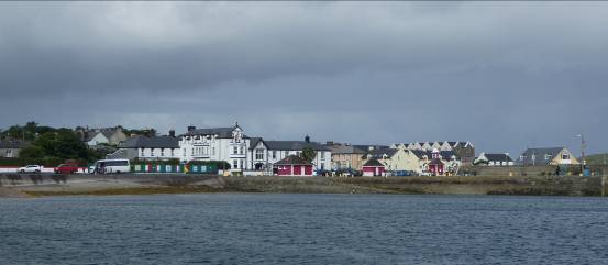
Tue 14th June. A relaxed departure from Cahersiveen, motoring through the channel & out of Doulus Bay, then with the wind on the beam, unfurling the genoa for an easy, but quick sail across Dingle Bay. Approaching Dingle we furled the sail & the engine went on again as the entrance was busy. A small cruise liner was dropping anchor, fishing boats were charging in to unload, & various ‘trip’ boats were dashing in circles trying to give their clients a view of the local celebrity, Fungie. Fungie is a bottlenose dolphin who has been around the Dingle area since the 1980’s. He apparently likes human company & the trip boats virtually guarantee a sighting, hence the mayhem. Once clear we headed to the marina & were found a berth. 17.1 nm.
We plan to leave the boat in Dingle while we return home for a week, but have a few days before our flights from Kerry airport.
So wed (15th June) was a ‘domestic’ day –
restocking, laundry, boat jobs, etc.
Then thurs (16th June) we took a bus to the airport &
hired a car. A change of bus meant we
could look round the town of
Friday (17th) we drove west from Dingle on the
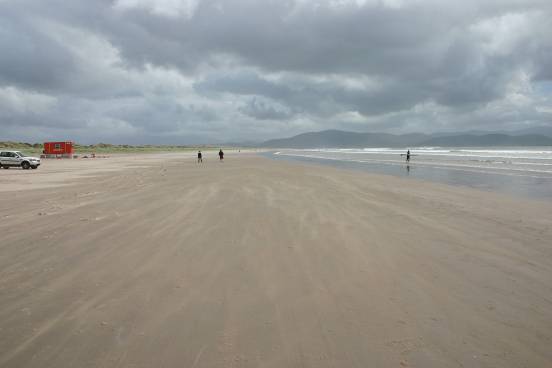
Slea Head circuit. First past the lovely
golden beach at Vestry, then explored the iron age promontory fort of
Dunbeg. Unfortunately a large part
inaccessible due to cliff erosion. Next
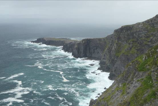
some cliff hanging bends around Slea headland with lovely views to the offshore
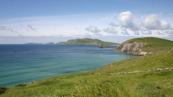
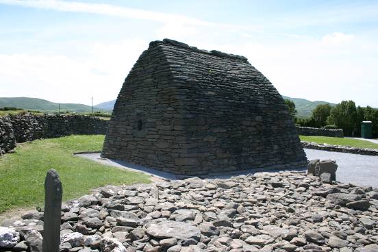
Sadly the driver was unable to savour the views! A stop at the Blasket Centre for a 5 km loop walk (Lub na Cille) starting uphill (good views), then descending to the cliff edge for the return. Lunch in Dunquin, then our plans for another walk were thwarted by lack of parking spaces. So on to the Gallarus Oratory, built about 1300 yrs ago of dry stone, including the sloping roof.
Finally along the North coast of the Dingle peninsular as
far as Mt Brandon & the narrow rocky cleft of
Saturday (18th) via the Inch road to
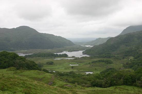
Next a walk to take in the 60 ft high Torc waterfall from bottom to top, more lovely views, then down again via another path. Into the Muckross house area for lunch, a walk round the outside of the elegant house, its gardens & to the middle lake edge. Then south to the upper lake & its famous ‘Ladies View’ northwards. Unfortunately for us Irish mist was coming in so the view was not at its best!
Returned to Ross castle, on the lower lake, by now the ‘mist’ was rain & there was a wait for the castle, so we headed back to Dingle. This time via Tralee & Blennerville, with its windmill & disused canal, on the north side of the Dingle peninsular. Sadly the hydraulics for the canal’s lock gates were damaged so it is unlikely to be reopened.
From there the coast road led to the notorious Conor pass. A mistake, the road is exceedingly narrow & winding with craggy rocks on both sides. By the time we got there the rain/mist/murk had set in in earnest. It was a fraught drive & we couldn’t see the views. To add insult to injury the Sunday (19th) the rain continued virtually non stop, one couldn’t see the other side of the bay, or the hills behind the town so it was not worth doing any sightseeing & the car stayed put.
Mon 20th June. A final check of the boat then to the airport for our flight home. A kind friend met us at Stanstead so we were home in good time. Thank you Vicky. Then a week of catch up – mail, jobs, outstanding appointments etc. The boiler got a service, I got a new camera (mine of several years died in service), we helped friends move a boat down river, voted, went to an indoor (due to weather) bar-b-q, entertained & were entertained & the phone worked overtime! Then monday week (27th) the same kind lady delivered us back to Stanstead for our return flight. Thanks again Vicky. A taxi returned us to Dingle by mid evening. The boat was secure as we had left her. Tuesday (28th) was a damp day, but we dodged the heaviest rain to shop, collect laundry etc.
Wed 29th June.
A lunchtime departure from Dingle.
No sign of Fungie. Unfurled the
genny for an easy sail across
Next day (30th June) dawned wet & windy. Waited until a mid morning lull then cycled south to the bridge across the sound to Portmagee, on the mainland. A small picturesque fishing village, also the start point for most of the boat trips to Skellig Michael so quite busy. After a pub lunch, in ‘the Moorings’ headed North on the mainland side. Got caught in a seriously wet shower before we got back to Reenard & the ferry to Knight’s Town. (18 miles). It continued wet & windy next day (1st July) so we seized a lull to walk up to the old school, now a Heritage Centre - very interesting with information & pictures or photographs on island life. It covered all manner of things including the laying of the Transatlantic telegraph cable, the earlier ferries & battle to get the bridge, the RNLI, island life, slate quarry, a lady marine biologist of a century ago, & a cast of the tetrapod trackway footprints, to list but a few. Varied the route back via the shore road & Altazamuth path (memorial stone). Later went to an early supper at the Royal.
Saturday (2nd) brighter, but still a lot of wind & big swell around. Took the bikes inland up a very long hill, albeit not too steep a gradient, to the base of Geokaun mountain. From there we walked to the summit (319.5 m) via viewpoints, first over the dramatic Fogher cliffs.
Then others back to the mainland & down to the slate quarry & tetrapod trackway.
This is the first fossil evidence (385 million years old) of a 4 footed lizard that pre-dated the dinosaurs. Our return on the bikes was very quick!